 Portions of the following information were taken from Florida Geological Survey Bulletin 66.
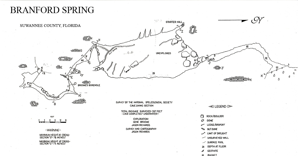
Branford Spring is located within Ivey Memorial Park in the city of Branford, 500 ft southwest of the
junction between US 27 and US 129 on the east side of the Suwannee River. The spring is just east of
a dive/bait shop.
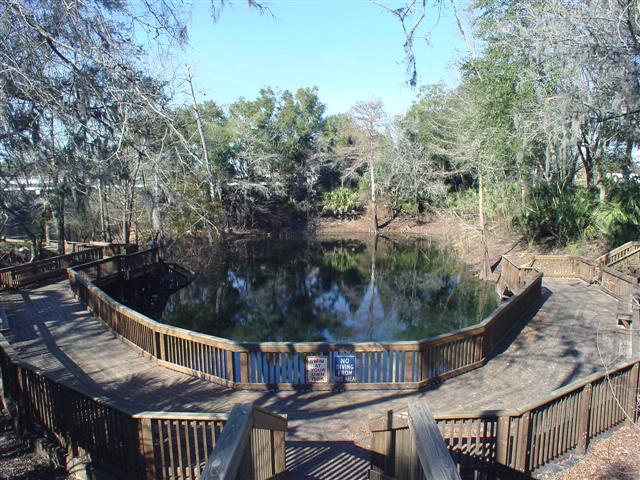
Description Branford Spring is situated in a steep-sided depression along the east side of
the Suwannee River. The spring pool is nearly circular and measures 90 ft in diameter north to south
and 84 ft east to west. There are small boils on the surface over at least two vents within the
spring pool. The depth at the sampled vent measures 12.5 ft. The water is clear and has a blue-greenish
hue. This spring has an abundance of long, filamentous algae covering nearly all substrates and waving
in the currents. There is very little other aquatic vegetation. Its banks are nearly vertical, rising
to approximately 18 ft above the water, and limestone is exposed in and around the spring. A wooden
platform is built along the south and east banks. The shallow spring run travels approximately 100 ft
northward, then turns sharply west and flows 100 ft into the Suwannee River. The spring run is sand-bottomed,
and spills into the river over three consecutive man-made limestone walls. The walls are presumably intended
to maintain water levels in the spring pool for swimming. Land around Branford Spring is developed into a city park.
Utilization The spring is within a city park and is a popular local swimming hole.


