| 11/27/2024 |
Teddy Garlock |
60 |
RIPPIN' flow, great fun. |
| 3/12/2016 |
Ryan Hoffman |
30-40 |
Very nice dive today. The last two months or so every time I have dove Ebro there was river water in the basin. Today the basin was completely clear. River level at Caryville was 9.06 ft. The flow in the cave was normal but the vis was low only about 30-40 ft. We scootered to the blue water tunnel and made the jump and the vis never really improved. Over all great dive. |
| 1/31/2016 |
Derek Villiard |
30' |
River is way up. Visible boil, flow is lower than my last dive here but still very high! Vis is crystal clear at the vent but diminished shortly into the system. Travelled the blue water tunnel to 3300'. |
| 11/24/2012 |
Ryan Hoffman |
50 ft |
The basin was clear with a boil on the surface. Dove to about 700 ft back. It was clear the whole way. |
| 9/2/2012 |
Ryan Hoffman |
50' |
Dove the basin and about 100' into the cave. The basin was clear and the spring run was clear about half way to the river. Also dove Potters cavern, there was damage to the lines. The lines went down into the bottom of the cavern and then were broken off into a debris pile. There was a small restriction that I did not go through but the lines were either berried under a lot of sand or broken. Just be prepared to repair lines if you go there. |
| 2/5/2012 |
David Dewberry |
40' - 50' |
Basin clear with visible boil on surface. Very strong reg purging flow on entry, decreasing to moderate in the system. Percolation reduced vis to 30'ish on exit. |
| 3/30/2011 |
David Dewberry |
40' |
Spring run began to clear about 100' from the river. Water level in basin up with visibilty 15'; large boil on the surface. Flow exiting the vent very strong, decreasing to moderate inside the system. |
| 11/22/2010 |
Andreas |
30-50' |
The spring run was clear all the way out to the river. Incredibly strong flow, but still very silty walls and ceiling. Percolation from ceiling really bad. |
| 5/8/2010 |
Mathew Bull |
50' |
Waterlevels higher than I've ever seen, river water right up to the basin, but still a strong boil. Flow was noticably down due to the head pressure, but still very prevelant. |
| 3/20/2010 |
Mathew Bull |
50' |
Water level is way up, but the spring is still pumping hard, no noticable reduction in flow. Vis is great in the cave, basin is blown. |
| 3/7/2009 |
Forrest Wilson |
50' |
Current moderate, Viz good. River was up some. |
| 1/24/2009 |
Mathew Bull |
40-50' |
Flows really ripping, but cave is great. Basin's even clear. |
| 12/28/2008 |
Mathew Bull |
40-50' |
Water levels in the basin were high, but the water was clear. Strong boil with clear water and the cave was still clear, flows pumping hard. |
| 12/14/2008 |
Mathew Bull |
50' |
Basin is inundated with floodwater, but there's still an impressive boil. Lots of flow going into the cave and noticable flow throughout the dive. Visibility within the cave isn't suffering despite floodwaters in the surrounding areas and the flow is still strong and shows no sign of blowing out. |
| 4/8/2008 |
Mathew Bull |
60-80 |
Flows ripping, cave is outstanding |
| 3/22/2008 |
Mathew Bull |
40-50' easily |
Water levels are up enough to make transit through the run easy, but low enough to keep the run and basin clear. Flow is up, expect regs to purge and to go hand over hand on the rope to enter the system. |
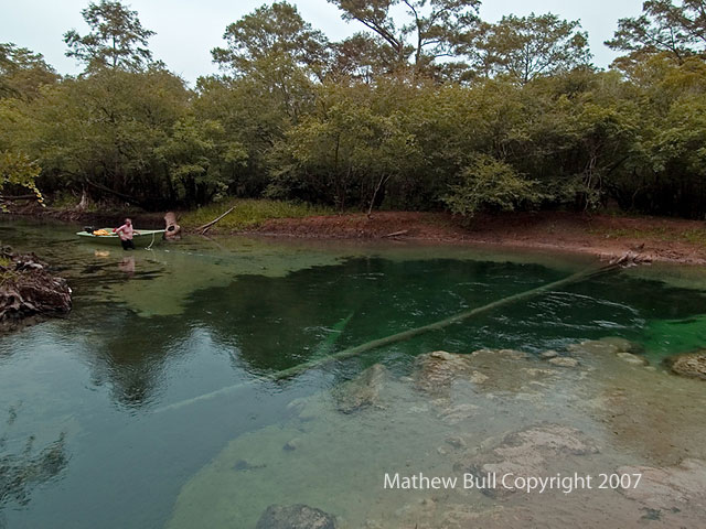
| 12/1/2007 |
Mathew Bull |
50-60' |
River and run are flooded, basin is trashed, cave is great, flow is down. |


 Portions of the following information were taken from Florida Geological Survey Bulletin 66.