 Portions of the following information were taken from Florida Geological Survey Bulletin 66.
Santa Fe River Rise is located within O'Leno State Park/River Rise Preserve State Park. From the junction
of US 441/41 and US 27 in High Springs, head north on US 441/41 approximately 6 miles to O'Leno State
Park entrance on the east (right) side of the road. Directions to the river rise via park roads can be
obtained at the park entrance.
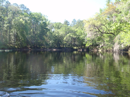
Description - Santa Fe River Rise is the re-emergence of the underground Santa Fe River. The
spring pool measures 175 ft east to west and 165 ft north to south. There is a vertical limestone
ledge on the northeast side of the pool. The depth just south of the ledge measures 49 ft. The water
color is typically that of the Santa Fe River, which may be tannic or clear depending mainly on
rainfall. No boil was observed during the October 2001 visit. The river flows southward from the vent
and is approximately as wide (east to west) as the spring pool. There is a narrow band of cypress
growing around the pool perimeter. There are patches of duckweed around the periphery of the pool,
and no aquatic vegetation could be seen through the tannic water. Several hundred yards of the Santa
Fe River below Santa Fe Rise is choked with water hyacinth, and boat access to the rise is nearly
impossible. Land around the river rise quickly rises to approximately 8 ft above water level and levels
off into a flat mesic hardwood hammock.
Utilization - The Santa Fe River Rise is a pristine, state-owned natural area.


